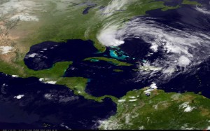
 Honestly, it’s looks beautiful from space in this NOAA Imagery. Doesn’t it?
But Hurricane Sandy will combine with another one as it approaches the Northeast early next week to create what’s been nicknamed the “Frankenstorm” that’s due to make landfall just before Halloween 2012.
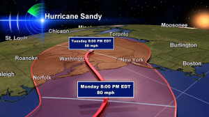
 As of early Saturday morning October 27, 2012, this is the forecast for where the center of Sandy will go. As of this writing, it could make landfall anywhere between about Norfolk Virginia and Long Island, New York. That’s the area you see in red. In Meteorology, we call this the ‘cone of uncertainty’ because this many days our, errors in the forecast track are often quite large. So ignore the center line for now and focus on the area in red as potential landfall areas. Winds in this graphic are sustained wind speeds.
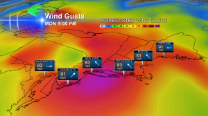
But remember, too, hurricanes are not just a single point. This storm will likely create damaging winds for hundreds of miles. One of the forecast models puts near 100mph gusts in major cities. Power outages are going to be a huge story if this map below is even close to correct.

This much wind will also create damaging storm surge—especially north of where this storm makes landfall. That’s where it should be the worst. So watch for that.
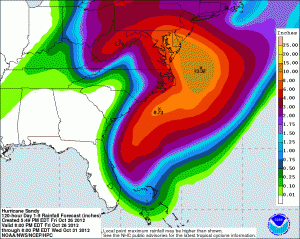
And then there’s the rain. As of early Saturday morning, these were the forecast rain totals estimated to fall from the storm. Flooding will be another big story.

If you want to track Hurricane Sandy, straight from the source, check out the National Hurricane Center. Click on Public Advisory for details in plain english. It looks like this storm could make history early next week.
Leave a Reply