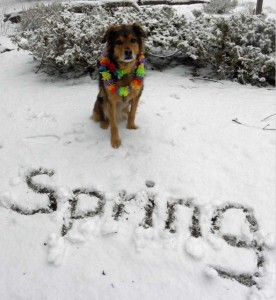
 It’s a classic spring photo: Maty, the dog, wearing her lei on the first day of Spring near Bend, Oregon. P-o-o-r Maty!
Shannon Mendiola tweeted this photo and says she wishes Central Oregon snow would stop now that it’s spring but she resigned herself to whatever comes: “it is what it is!”
If you live in Washington or Oregon that attitude may come in handy this spring.
Northwest Spring Outlook 2011 Is For A Cool One
Based on what’s going on with weather trends, a weakening La Nina and other factors, odds favor a cooler than usual April, May and June for most of Oregon (including Portland, Salem, Newport and Bend) and all of Washington.
When it comes to rain, things are less certain. So much so it’s hard to say whether spring will be unusually wet or not.
But anytime spring is unusually cool, in my opinion, it seems we’re at least due for grayer than usual skies with more clouds. That’s the part of spring that drives me crazy! So, now you know what to look out for.
Late Fall & Winter 2010-2011 Portland Wrap Up
I use Portland as our point of reference here because it’s the home of our long term records. Remember, we’ve just come through a La Nina winter and it was supposed to be wetter and cooler than average with a bigger mountain snow-pack. Here’s what happened:
- November 2010 – cooler than average, wetter than average
- December 2010 – warmer than average, much wetter than average
- January 2010 – warmer than average, drier than average (whoops!!)
- February 2010 – cooler than average, average rainfall
- March 1 to 21 2010 – cooler than average, much wetter than average
Cascades snow-pack including the snow on Mt. Hood was a let down, falling short of expectations. But, we still worked in a lot of great snow days on the mountain for skiers and boarders. So that’s good.
Why La Nina 2010-2011 Did Not Act Like It ‘Should Have’
First of all, only about two-thirds of La Nina’s act ‘like they’re supposed to’ where the averages we expect are the averages we get. So that means a third of these are going to be ‘hybrids’ like this year, or in some cases, a bust.
Second of all, La Nina is competing against other kinds of circulations, oscillations and cycles that play a part in altering what we expect. Many of these things are still poorly understood.
Third, this La Nina was forecast to be ‘moderate to strong.’ The stronger it is, the more reliably we get the impacts we expect. This ended up staying ‘moderate’ which is just a bit more squirly in the forecast department.
When it comes to low elevation snow, this La Nina worked out pretty well, in my opinion. If you look back at my winter forecast for this year,I never promised lots of snow for Portland or the I-5 Corridor. Instead, I talked about low elevation snow for places like the Coast Range and hilly parts of Oregon & Southwest Washington. And we did have several rounds of foothill snow – including lots of places 800-1,200′ in elevation.
We also had an early season arctic blast that you may have forgotten about. Even I can barely remember it! Total snow for Portland was about 2″ for winter 2010-2011. Well below our long term average. As I said in my forecast: some La Nina years deliver sea level snow. Others, not so much. This was a not so much year for many of us.
Next winter, what do you say we go big on valley floor snow? Are you in?

“Next winter, what do you say we go big on valley floor snow? Are you in?”
I’m waaaayyyy in, with both snowshoes!
I knew I could count on you, Cynthia! We’ll see what happens…
Bruce-
I’m wondering if you have any winter projections for this upcoming year. I will be travelling over 26 and 22 from Portland twice a week through the first of march and I would like to know what I’m getting myself into.
-thanks
Jason–I’ll have another update in a couple of weeks. I want to wait and see how this La Nina is developing because that will certainly impact what kind of winter is likely for your drives over the mountain! So stay tuned, as we like to say…