 Earthquakes are strange, aren’t they?
You never really expect them.
You kind of forget the earth under your feet can move.
And then there’s a strong earthquake somewhere and you wonder: when will the big one happen near me?
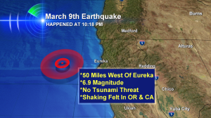
That’s what I was thinking as I was posting quake and tsunami updates on social media–minutes after the 6.9 Earthquake off California on Sunday night March 9, 2014.
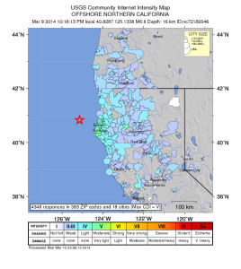
As this map shows, the earthquake was felt throughout the San Francisco Bay Area and in Oregon as far north as Eugene, home of the Oregon Ducks.
 The areas colored in on this map show the places people reported feeling the earthquake.
Why Didn’t The 6.9 California Earthquake Create A Tsunami?
This is a great question. And several people asked me that very thing. For starters, the USGS, the world’s foremost experts on earthquakes says this was a ‘strike-slip’ fault. This kind of fault causes an earthquake when different parts slide past each other. If this was a subduction zone earthquake, part of the fault would actually lift upwards–lifting the ocean water with it. That water then goes out as a tsunami wave. So this was the wrong type of fault to cause a tsunami.
The Tsunami Warning Centers that gave the all clear on this California earthquake look at fault type, magnitude (for an ocean wide tsunami you typically need a 7.0 magnitude quake or higher) and history. And within 60 miles or so (approximately 100km) the USGS says these are the offshore quakes since 1900.
- 7.2 magnitude earthquake – 1922
- 7.1 magnitude earthquake – 1923
- 7.3 magnitude earthquake – 1980
- 7.0 magnitude earthquake – 1994
- 7.2 magnitude earthquake – 2005
- 6.9 magnitude earthqake – March 2014 (the current earthquake)
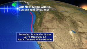
And now, back to my originial thought: when will the ‘big one’ hit near those of us in the Pacific Northwest? The answer is…it could happen tomorrow. Or perhaps decades from now. But we know the “Subduction Zone Earthquake” has the potential to rupture offshore from British Columbia to Washington to Oregon to northern California. When this happens the earthquake may be bigger than a magnitude 9.0 — this last happened in 1700. And research shows most of the time, this subduction zone ‘goes off’ every 300-500 years. As of now, it’s been 314 years.
 The red line represents the subduction zone that stretches approximately 900 miles. We’ll know when this thing ruptures. We’ll feel minutes of shaking. And along the coast, that shaking will flat out knock you to the ground.
If you live in the northwest…I highly suggest earthquake insurance. It’s not cheap–but for my family–it’s mandatory!

Leave a Reply