 For the last two evenings, I’ve been talking about the chance for low elevation snow this weekend in the Willamette Valley and Southwest Washington.
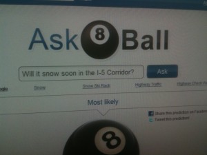
But this morning, I needed a definite answer to this question: Will it snow soon in the I-5 Corridor of Oregon and SW Washington?
Sometimes I turn to the Weather Guesser 6,000. But it always leaves me, um, guessing.
So I posed the question to the source of knowledge I’ve consulted since the 1980s – the Magic 8 Ball. And it looks like more snow may be a go around here based on the answer. I just hope the 8 ball has gotten more accurate since my sophomore year in high school, ha-ha!
The Latest ‘Real’ Outlook For Weekend Snow
- Saturday morning February 26, 2011 started with a record low of 18 degrees in Portland, breaking the old record of 20 set back in 1962
- Clouds moved in more quickly than any of our forecast simulations showed. This blocked the relatively strong late February sun and helped ‘lock in’ the cold. Portland’s high temperature was just 32 degrees-a record cool high. All I-5 Corridor cities from the Portland-Vancouver area and north are about the same.
- A cool system is coming down from the northwest to meet this freezing air.
- Along the coast you might see a quick burst of snow or flakes mixing in with rain before warming quickly because of a SW wind.
- Most inland areas from Portland north will get just snow from this system to start. The atmosphere is certainly cold enough for that.
- For now, I believe the places that received the most snow from our last system are the most likely to get some accumulation.Forecast simulations develop snow this evening over Northern Clark County, Cowlitz County & Northern Columbia County along with the northern Oregon Coast Range and coastal hills of SW Washington.
- For the Portland-Vancouver area the forecast simulations show little to nothing this evening with a better chance of snow in the overnight hours and Sunday morning. We’ll see how that plays out.
- Down toward Salem and Corvallis it’s tough to say if you’ll even see any snow. It’ll depend when moisture reaches your area because a warmer south-southwest wind should warm you into the ‘rain zone’ first as is typically the case. But, honestly, in this case: there’s not much warm air to our south.
- And so the battle begins: light moisture coming in that will fall as snow. But extremely dry air in our skies right now will ‘eat up’ quite a bit of that moisture before it even hits the ground. Ultimately, that plays a part in how much snow we see.
-  It’s a developing situation for sure–one that will require ‘nowcasting’. That is, forecasting the finer details as they’re unfolding and we see how much moisture we have to work with and how slowly or quickly a warm up is working up the Willamette Valley.
 By the way: if you want to ask the Magic 8 Ball any questions you can visit its web site.
Let me know if the answer changes on snow! And be sure to keep an eye on the KOIN Local 6 radar this coming week. Snow levels will spend a lot time between 500′ and 2,000′ this week.

Leave a Reply