 A wild Wednesday in so many ways.
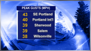
Peak gusts from the south topped 40mph some places–hitting their max between 7 and 10pm. Thousands lost power.
And temperatures shot up after dark. Portland was about 10 degrees warmer at 11pm than it had been at noon!
We had a dusting of snow in Hood River, inches of snow in the Cascades and rain–lots of rain. Both Lincoln City and Newport topped 2″ for the day. Most of the metro area had .50″ to 75″ — and it fell in buckets right as I was doing the 11 o’clock news.
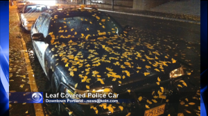
   On my dinner break I came across this leaf covered Portland Police Car–just outside the former Occupy Portland Camp. Guess you could say these leaves are now ‘occupying’ the Police car!
Falling Snow Levels Underway
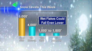
Colder air moving into our skies today means sun breaks, downpours and probably small hail. 5-10″ of Cascades mountain pass snow. Snow levels fall, too–and we’ll want to watch these very closely starting tonight! The Coast Range and Cascade foothills could be quite snowy starting this evening.
 Â And if you live on a Portland area hilltop, I won’t be surprised if you get a quick shot of snow from a passing shower tonight or Friday morning. Should be exciting…but mainly…a tease!
 And if you live on a Portland area hilltop, I won’t be surprised if you get a quick shot of snow from a passing shower tonight or Friday morning. Should be exciting…but mainly…a tease!

Leave a Reply