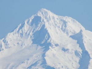
 That’s right. I’ve heard the rumors of Portland snow. Have you?
I was on a dinner-date with our four year old last night at Buster’s Barbecue. He had the chicken leg kids plate. It comes with a 4-pack of Oreo’s for dessert–and I’m pretty sure it’s the real reason he wants to eat there. I had the beef brisket. That’s the real reason I want to eat there!
But anyway, I hear the table next to us mention something about the weather. Not just something–but the very something we love (or fear) the most around here: Willamette Valley and Portland snow. The guy says, “Yeah, it’s supposed to snow on Saturday.”
Yes, I’ve now officially heard the word on the street!
What’s Likely To Happen This Week
Before we get to low elevation snow, we need to talk about potentially our biggest soaking of rain in months. Wednesday looks like it’s going to be one of those all day rain bonanzas that could dump as much as an inch of rain on west side cities, with much more for the Coast Range and Cascades Foothills. It will be a mild system, pushing the snow level above mountain passes for a good chunk of the day, too. My advice on this one:Â if you’ve got clogged storm drains by your house (and really, who doesn’t right now?) I’d get those cleared before Wednesday.
Sometime late Wednesday or early Thursday, a cold front will move through. A cold front gets its name because it is the front (or leading) edge of colder air. So, behind it, we’ll see scattered rain showers in the valley and much cooler temperatures along with falling snow levels.
Major Cascades Snow Event Likely
Thursday looks like it could be the biggest snow day of the year for our mountain passes and ski resorts. Moist air coming in off the Pacific should slam the mountains and squeeze out more than a foot of snow. If this pans out–we may not have to wait until Thanksgiving for ski resorts to open. After Thursday, Mt. Hood should basically look like the picture in this post.
Low Elevation Snow Chances
If you were watching my forecasts last week on KOIN Local 6, you heard me mention the chance for our lowest snow levels this fall — at the end of this coming week. I said I’d watch it closely and I have been. So, here’s what I’m seeing as of now:
- Yep, still looks like the lowest snow levels of the season
- Accumulating and significant snow is possible on the higher Coast Range passes & the Cascades Foothills either Thursday night or Friday
- In a heavy shower that lasts long enough, I could envision snowflakes making it below 1,000’Â during this time frame – how low will depend on a whole bunch of minor details that still have to be ‘sorted out’ as we get closer to the end of the week
- I think we all need to watch the forecast closely this week – the forecast models are kicking around a couple of different scenarios that get us cold enough for valley floor snow–if there’s any moisture left. Or, perhaps, as another system comes in next week. But this is very speculative this far out. So stay tuned.
So, is the rumor I heard last night at dinner, true? Will we see valley snow this week? We’ll all find out together as cooler air moves in later in the week!
I’ve been watching the models closely too, ever since I saw on the UW site last week that we could be seeing the 1000-500mb thickness dropping below 5220m. But I’ve seen 2 things as I’ve looked at the models. 1) we’re simply going to be too warm in the valley, highs for Thursday and Friday are expected to be in the low 40’s still. But we could still get snow over night I suppose if the forecasted lows around 35-36 can notch a few degrees lower. But then there is problem number 2) The last couple model runs have shown the cold air simply not sticking around very long before it is pushed off. That dip in the thickness which originally looked like it could get down to 5200m or lower is now looking to barely breach the 5220m mark and only for one forecast period (Friday afternoon I believe).
I may be off the mark, and I’d LOVE some valley snow (big snow fan), but to me it just seems like the ingredients aren’t there. The 1000-850mb thickness is looking to be a bit too large. However, snow levels down to 1000 feet definitely seem possible.
This is just what I’m seeing. If you’re seeing something different, maybe something more positive, I’d love to hear about it. I don’t get much chance to discuss meteorology with other people because my friends and family don’t care about the science at all.