So…was that it?
Did Portland’s epic warm and dry summer of 2017 come to a crashing hault before we even reached October?
Try these numbers on for size as a ‘crashing hault’ type scenario:
- September 28: Portland hits 86 degrees without a cloud in the sky
- September 29: Portland hits 64 degrees. Whoops, we lost 22 degrees in 24 hours!
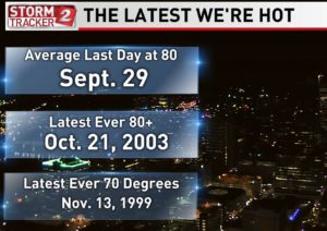
I always turn to the Portland weather record books in cases like this and I shared the “How Late We’re Hot” graphic the other night during my forecast on KATU.

So, on average, Portland is done with 80 degree days by September 29. In some ways, a crashing hault to summer weather is just right this time of year. And I do believe we are done with 80 degrees or warmer unless there’s a drastic change to our northwest weather pattern.
Statistically, we have lots of time for 70 degree days which I expect will happen at least a few more times this year before it’s ‘all over’ until 2018.
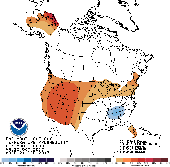
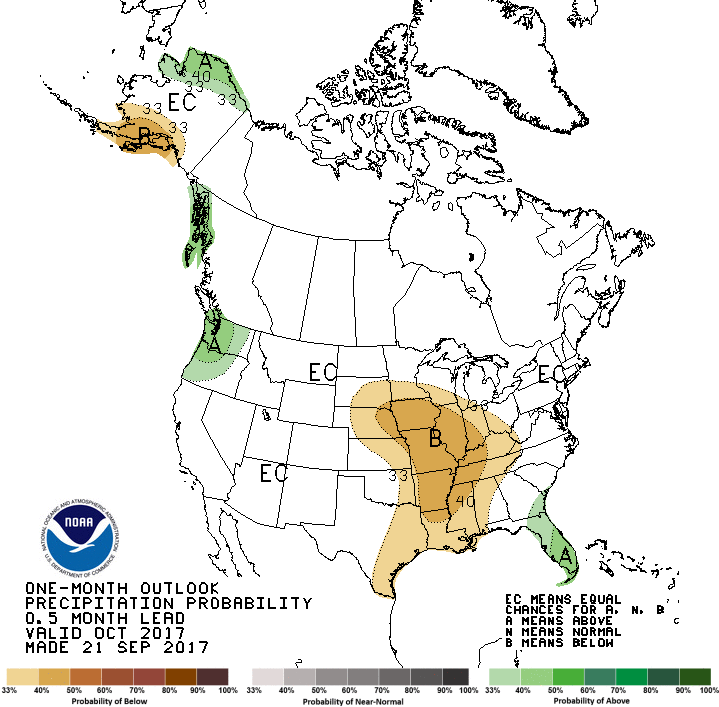
Interestingly, the Climate Prediction Center which issues long range forecasts – is predicting October will be unusually warm in the northwest and unusually wet. It’s a bit odd, because the warm and wet typically do not go together as a month long trend. Here are the maps:


What’s interesting to me about both of these forecasts is that they are hot off the presses – made on September 21, 2017. Based on what I’m seeing now, summer heat is over and the above average temperature forecast may be a bust in October, while the map on the right showing above average rainfall for most of Oregon and Washington, seems to be most likely to come true.
There is more to come on this story. I just hope some of the pages have 70 degrees written on them!

Leave a Reply