 The snow was crazy Thursday night on Mt. Hood. Hopefully you saw Joel Iwanaga’s live shot at 11! Snow was falling at an inch an hour with constant gusts of 55-65mph just up above Timberline Lodge.
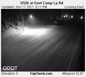
And it’s like ‘instant winter’ at Goverment Camp as you see in this Thursday night ODOT shot.
The snow level will be dropping Friday, but before I go one, here’s a link to bookmark:Â you can find local alerts, watches and warnings, anytime:Â http://www.koinlocal6.com/weather/alerts.aspx
You can also download the PinPoint PDX Weather App, free, for your Android, iPhone or iPad. You set your zip code—and the radar map is centered on you; local alerts instantly pop up and the forecast is based on where you are. So check it out! Sorry, I might love our app a ‘little too much’.
Now, back to the forecast…Thursday evening’s snow level of about 1,500’ holds, for the most part, into Friday morning as colder air slowly slides our way. We stay in the upper-30s Friday morning in most of the metro area so I don’t expect much of anything besides rain showers.
The Sticking Snow Level will be around 1,000’ most areas Friday night—with hit and miss showers around. But on the edges of the metro area, where colder air often develops, the sticking snow level will likely be a little bit lower. So that’s in the lowest elevations of the Coast Range – and at low elevations of the Cascades Foothills.
Any moderate to heavy showers on Friday evening could bring snow flakes to a few lucky people on the valley floor—but it’s too warm to stick.
Hilltops in the metro are a different story. There’s a chance for a light dusting with some of those Friday night showers–mainly around 1,000′ but a tad lower if showers are heavy. Showers should be on the decrease Friday night.
Our coldest temperatures are Saturday morning—we could see snow flurries just about anywhere—if there’s any moisture left as this system moves out. We’ll keep an eye on it.

Leave a Reply