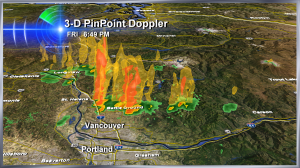
 For the first time in weeks, I used 3-D Pinpoint Doppler as clouds that created sprinkles over the Portland metro area–turned into downpours over Battleground. Look at those towers!
Speaking of things towering in the sky, this shot shows a massive smoke plume from the wildfire near Mt. Adams, Washington. It makes the mountain look more like a hill!
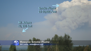 Thanks to Bill for a great comparison.
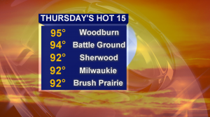 Temperatures soared on Thursday September 14, 2012. These were the 5 hottest cities (part of the ‘hot 15’ as I called them on the news) that day. Portland stopped at 89.
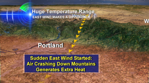 About the only way you’re getting into the 90s so late in the year is to have very warm air above us and an east wind blowing down onto us! And we did. It was breezy. This type of ‘downslope’ wind is similar to the Santa Anas in California and the Chinook in Canada. The air hits the valley floor and gets compressed and smashed by more air coming down on top of it and this acts to create heat. Seperate from what the sun can do by itself.
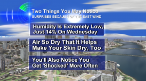 On top of these things–lots of you said you had ‘fly away hair’ — I should’ve put that on the list!
What’s crazier than all of this? The week of September 16th also looks unusually warm, again, and I have a feeling some of us will hit 90 degrees again. Stay tuned!

We had the smell of smoke in the Rainier, OR area along with haze. Must’ve been from the forest fires by Mt. Adams.